Last Thursday’s part aborted walk wasn’t quite the disaster it could have been, as looking back there were plenty of pluses to counter the minus caused by a dodgy knee. Incidentally, I still haven’t got to the bottom of that, and whilst the longest walk I’ve done since then, is a 500-yard amble to post a letter, I’ve been on my feet for much of the past four days, doing all sorts of jobs in the garden.
The most annoying part of Thursday’s escapade is the need to go back at some stage and knock off the remaining two and a half miles. I haven’t yet worked out how to get to Knockholt Pound, using public transport, although there’s probably a bus, but in the meantime here’s an insight into the walk itself, along with the odd statistic which might just surprise you.
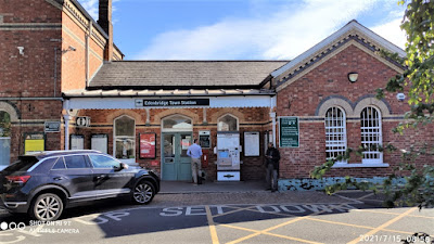
Using my Smartwatch, I clocked the walk at just over eight miles, but that’s just the time spent on the trail. It’s a mile from my house to the station, followed by me having to change stations at Edenbridge, and with a further mile between Edenbridge top station on the Tonbridge-Redhill line, and Edenbridge Town, on the Uckfield line, that’s two miles walked before I’d even set foot on the North Downs Way.
So, when I stepped onto the platform at Edenbridge Town, my Smart Watch was indicating that I’d already notched up over 6,000 steps. That was since getting out of bed that morning, but it’s still around the three-mile mark. On top of this it was another mile from Oxted station to the point at which I’d be joining the NDW – except it wasn’t.
Instead, I’d thought ahead and pre-booked a taxi to pick me up from the station, and drive me to the aforementioned spot, at the top of Chalkpit Lane. The way I looked at it, was this was an extra mile in my tank, for walking the trail, and however attractive the walk up through Oxted might have been (nothing out of the ordinary, as it happened), I wanted to save my legs, and my reserves of energy, for the main event, so to speak.
A few words about the train ride from Edenbridge Town to Oxted which, coincidentally was my first rail journey north, from the former, along what is known as the Uckfield line. The line is so named because it terminates at Uckfield, but it was once an important through route which ran from London to Brighton, via Lewes.
The reason the line now ends at Uckfield, is that the route it followed into Lewes stood in the way of a planned relief road for the county town, and rather than fight this decision, British Rail rather meekly gave in to East Sussex County Council and closed the line, to enable the road scheme to go ahead.
This closure took place in 1969 and, contrary to popular belief, was not the result of Dr Beeching’s infamous axe, but rather a short-sighted decision taken by two public bodies, who should have known better. For many years, the Uckfield line was a something of a “Cinderella route," starved of investment, and operated by antiquated rolling stock – the notorious diesel “thumpers.”
Two sections of the line south of Hever, were reduced to single track, as a means of cutting costs, but this exercise didn’t end well, as on 15th October 1994, two trains collided head-on, in heavy fog, just south of Cowden station, resulting in the deaths of both drivers, one of the guards and two passengers.
Since that tragic accident, enhance warning systems and other safety features have been installed, and there has also been investment in new rolling stock. The platforms at most stations along the line have extended to accommodate 10 car trains, and it was one of these sleek and modern, Turbostar diesel trains that I boarded that morning, at Edenbridge Town station. The train was quite full and was almost certainly the busiest service I have travelled on since before the pandemic.
I don’t intend to provide a blow-by-blow account of my walk, but it is worth noting it was the perfect English summer’s day, with hardly a cloud in the sky. I had to foresight to bring a hat with me, along with plenty of Factor 20 sunscreen, as I set off on my walk with hardly a care in the world. As I climbed gradually upward, I had a uninterrupted view of the nose to tail traffic, crawling along towards Gatwick, on the M25, far below me, as I continued in the opposite direction, as master of my own destiny.It was a long and stiff climb after that, up along Pitchfork Lane, but fortunately most of this stony track was through woodland which shaded me from the heat and the glare of the sun. The summit here, at Botley Hill, is the highest point on the whole of the NDW, reaching a height of 853 feet (260 metres).
Slightly further on, I halted for a brief rest, plus a bite to eat, at a viewing point, just below Clarks Lane Farm. The view southward was far reaching and quite spectacular, with the hills of the Greensand Ridge in the mid-foreground and the darker-looking summit of Ashdown Forest, on the horizon. With the sun shining, the scene spread out before me was a perfect patchwork of fields and patches of woodland.
A short way on, the long shallow descent off from the ridge began, as I followed the shady, tree-lined road, known as Chestnut Avenue. With an exclusive looking golf course on the left-hand side, and some very exclusive and expensive looking properties on the right, this area of leafy Surrey had a real 1930’s feel to it.
One house in particular, really caught my eye. On the white painted end wall, are silhouettes of Ratty and Mole from the "Wind in the Willows." The house is appropriately known as “Mole End.” I wish I’d taken a photo of it at the time, but fortunately I found the photo opposite, taken by Sean Davis, and available for public sharing, under a Creative Commons Licence.
As I wrote in the previous piece, the busy A233 road, at the end of the track, not only marked the approximate halfway point, but would also have been a suitable place to cut the walk short.
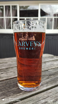
This brings me to the end of the walk, and salvation in the form of a welcoming pint of Harvey’s and the prospect of a taxi ride to the nearest station. Despite following the map as assiduously as I could, I became disoriented in the large area of woodland to the rear of Chevening House. I eventually emerged on the road running between the settlements of Knockholt and Knockholt Pound; the latter being the home of the Three Horseshoes pub.
I was gagging for a drink, and also in dire need of a place to sit down, so I headed straight round to the spacious and well-laid out garden at the rear of the pub. Before finding a table, I poked my head through the rear entrance and enquired about checking in. I was told I could sit at any table and a member of staff would come and take my contact details, along with my drink order. I also asked about booking a taxi, but that’s covered in the previous article.
With a choice on the cask front between Fuller’s London Pride and Harvey’s Sussex Best, I opted for the latter and mighty fine it was too. I suppose the trials and tribulations of the last four miles, made the beer taste even better, but I acknowledge the fact it was a mighty fine pint.There weren’t many people in the garden, nor indeed in the pub, but from what I observed on arrival, and also from a comment made by the landlord, a funeral wake had been taking place there, earlier that afternoon.
I will need, at some stage, to make a return visit to the Three Horseshoes, as there are still the final two and a half miles of that particular section of the NDW, to complete. I’m not yet certain when this will be, as the knee problem I experienced a week ago has reoccurred from time to time.
The more athletic of my work colleagues have suggested the issue could be tendonitis, and the best course of action, apart from resting my knee, would be to strap it up with an appropriate support brace. Choosing the correct type, will take a little research, both online and off, but if it allows me to pick up the trail, sooner rather than later, it will be well worth it.


